
AsianOverland.net
Tour Guide - Itinerary
Asian Overland Sydney to London
Started 22/06/2022 Finished 21/06/2023365 Days ITINERARY
Day 10 date 01/07/2022CEDUNA to EUCLA, WESTERN AUSTRALIA
ASIANOVERLAND.NET SYDNEY TO LONDON DAY 362/10: EUCLA, WESTERN AUSTRALIA
The name Eucla originates from an Aboriginal word "Yinculyer", referring to the rising of the planet Venus.
The Nullarbor Plain is flat, almost treeless, arid country north of the Great Australian Bight coast, with the Great Victoria Desert to its north. It is the world's largest single exposure of limestone bedrock, occupies an area of about 200,000 square kilometres, and stretches 1,100 kilometres from east to west.
The Nullarbor was occupied by Indigenous Australians, the Mirning clans and Yinyila people. Traditionally, the area was called Oondiri, meaning "the waterless".
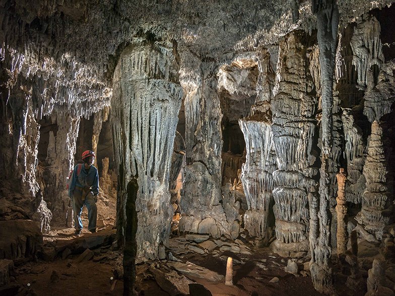
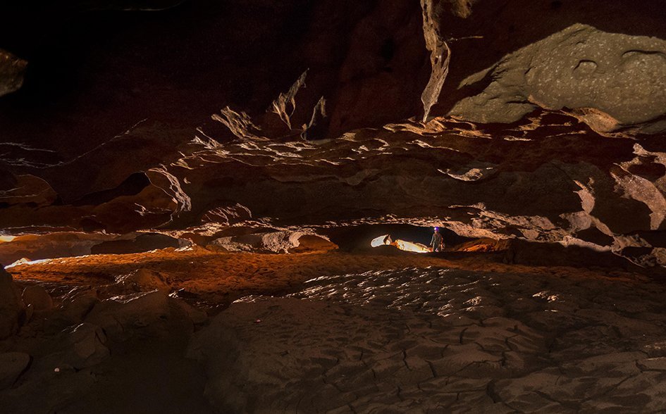
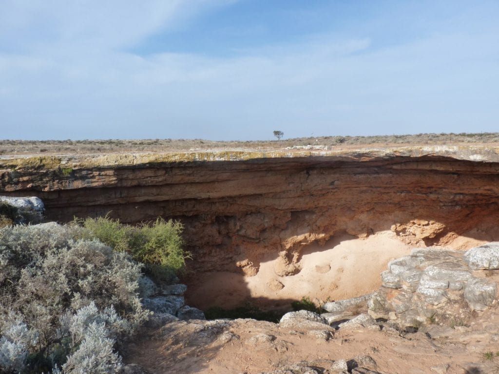
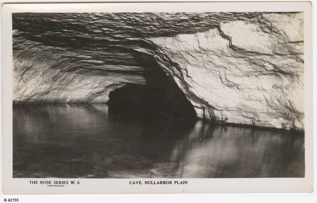
Koonalda Cave is 97 kilometres north east from Eucla within the Nullarbor Wilderness Protection Area, and is a notable archeological site.
I.D. Lewis described the cave in 1976:
“Large doline 60m in diam. and 25m deep; talus slope to two main large passages connected by a high window; total length of cave 1200m; three lakes at -80m; narrow airspace beyond third lake leads to 45m diam. dome and lake;”

Thousands of square metres in Koonalda Cave are covered in parallel finger-marked geometric lines and patterns, Indigenous Australian artwork dated more than 20,000 years old.
The cave was abandoned 19,000 years ago and rediscovered by archeologists in 1956.

In the 1960s, the cave was excavated by Alexandor Gallus, who found that Aboriginal peoples had mined flint there and cooked on a hearth dated 40,000 years old. A similar, older hearth is at Dempsey’s Lagoon near Port Augusta, over 40,000 years old.
Koonalda Cave was declared a prohibited area under the South Australian Aboriginal and Historic Relics Preservation Act 1965 on 30 May 1968.

Allens Cave is closer to Eucla and one of Australia’s oldest rock shelters. People started using it around 40,000 years ago. By the time people arrived, they had already developed outstanding skills and knowledge to live in harsh desert conditions.
During the last ice age (30,000 to 18,000 years ago), the Great Australian Bight was an escarpment, with fertile plains beneath it and the Southern Ocean 70 kilometres away.
The first signs of the incoming sea at Allen’s Cave are abalone dating to 14,700 years ago and cockles aged to 11,000 years ago, when the sea had reached the base of the present day Nullabor Cliffs, 100 metre high limestone cliffs that form the longest unbroken cliff line in the world.
During the British nuclear tests at Maralinga in the 1950s, the Australian Government removed the Wangai people from their homeland. Since then, many have returned to the general area. Others never left, despite the nuclear tests on their homelands.
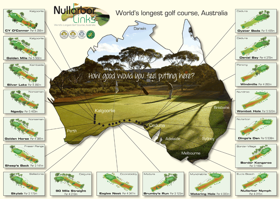
The Eyre Highway across the Nullabor Plain is the path of the world's longest golf course - the Nullarbor Links. You can play 18 holes on the 1,365 kilometre course, which stretches across the vast red plain and along the coastline, from Kalgoorlie in Western Australia to Ceduna in South Australia, with kangaroos, bush turkeys, wombats and emus.
© This work is copyright. Apart from any use permitted under the Copyright Act 1968, no part may be reproduced by any process, nor may any other exclusive right be exercised, without the permission of Peter Searle, peter@portseavillageresort.com; 1980-2024.
Website built by Justin O’Dea www.webdeveloperdocklands.com.au