
AsianOverland.net
Tour Guide - Itinerary
Asian Overland Sydney to London
Started 22/06/2022 Finished 21/06/2023365 Days ITINERARY
Day 30 date 21/07/2022NITIMLUK, KATHERINE to KAKADU, NORTHERN TERRITORY
ASIANOVERLAND.NET SYDNEY TO LONDON DAY 30: NITIMLUK, KATHERINE TO KAKADU, NORTHERN TERRITORY
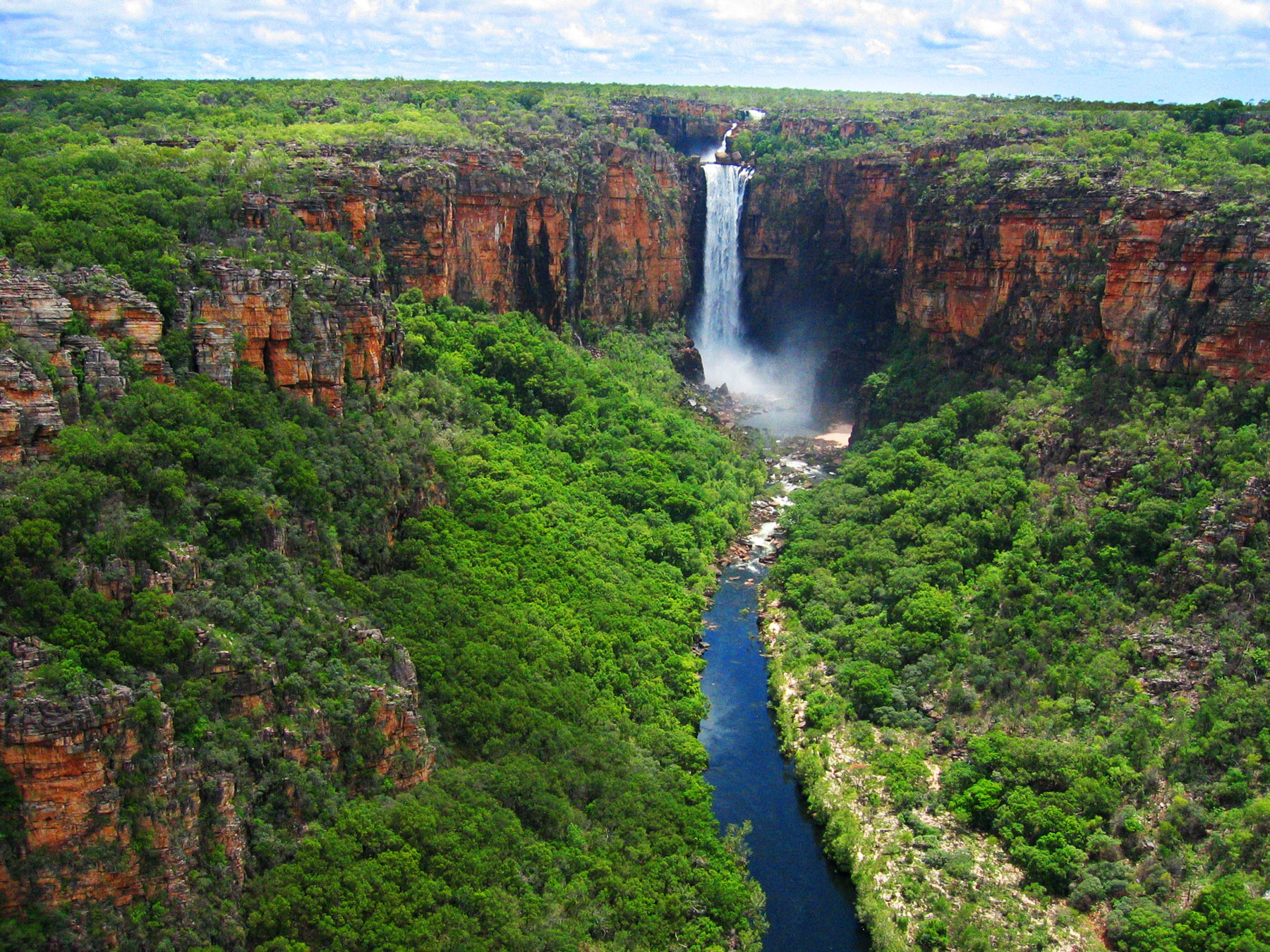
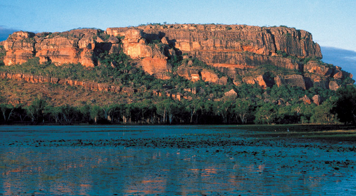
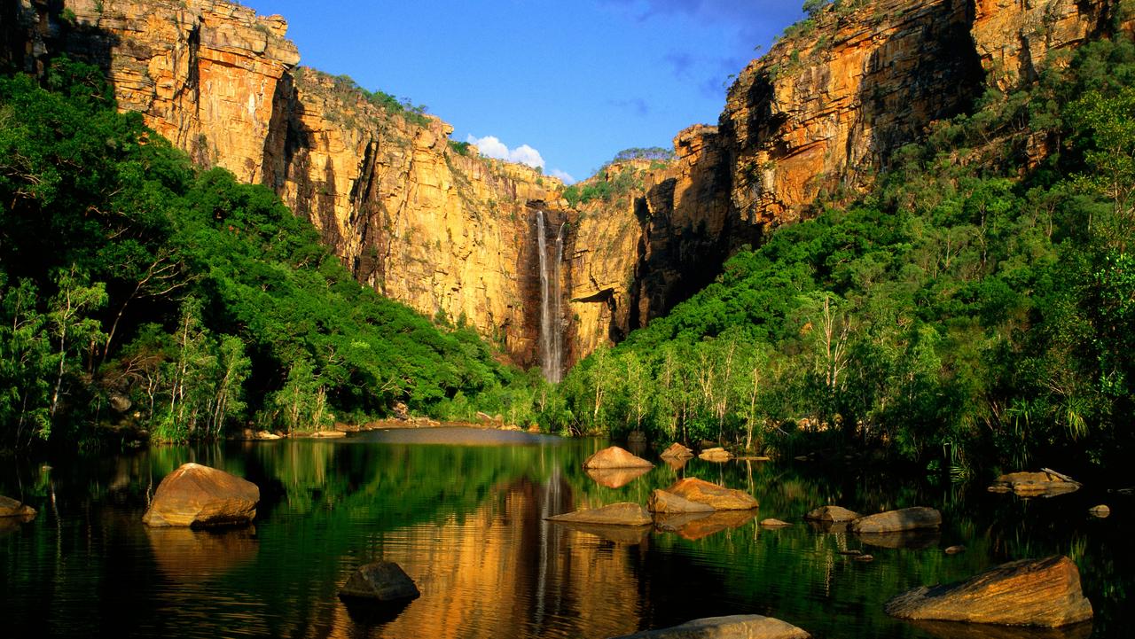
Kakadu National Park is a World Heritage Area within the Alligator Rivers Region of the Northern Territory. It covers an area of 20,000 km2, extending 200 kilometres from north to south and over 100 kilometres from east to west. Most of the area is owned by the Aboriginal traditional owners, who have occupied the land for around 60,000 years, and manage the park jointly with Parks Australia. It is ecologically and biologically diverse, with a wide range of flora and fauna, and includes a rich heritage of Aboriginal rock art.
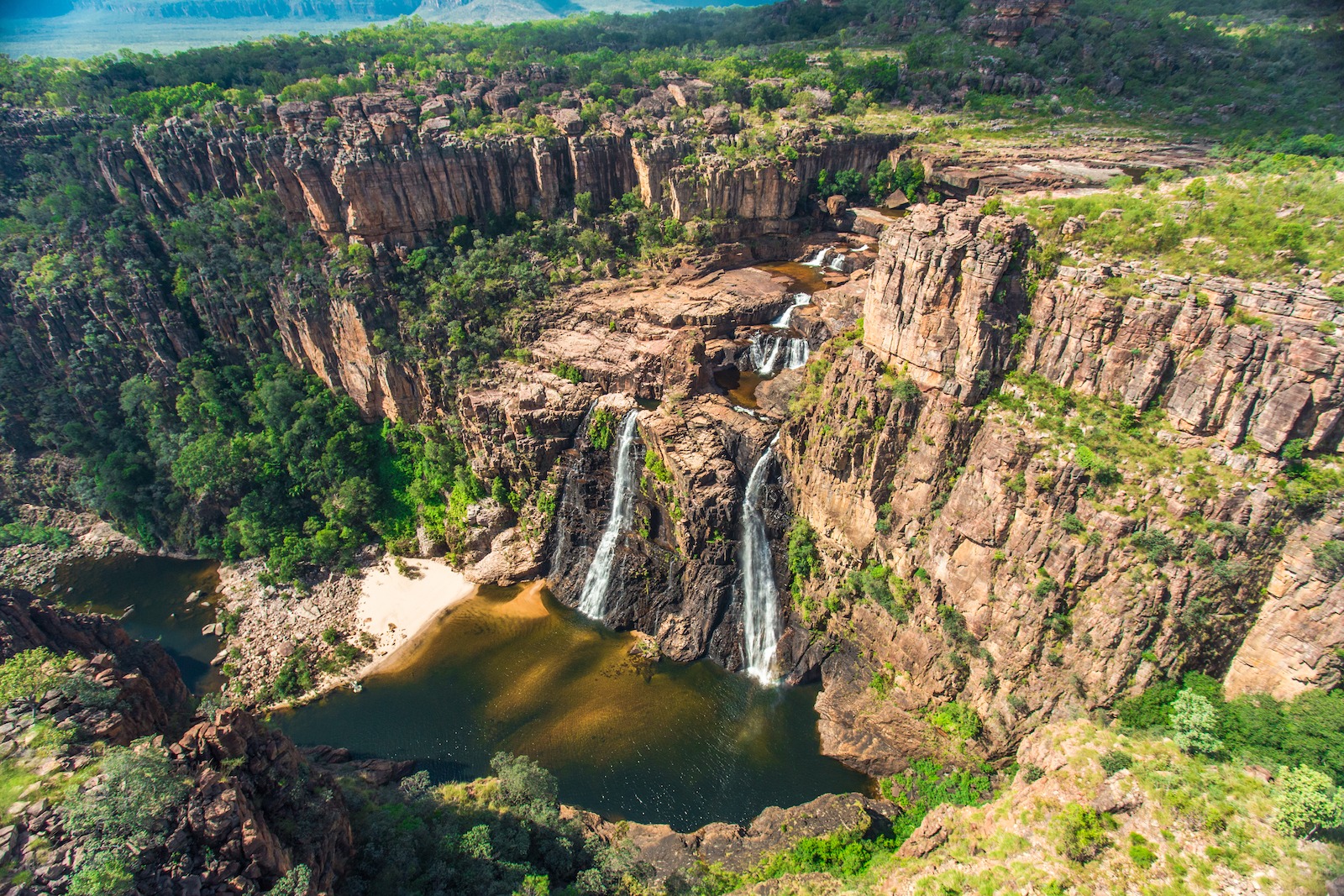
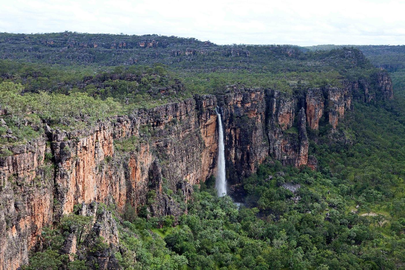
Most of Kakadu was under a shallow sea approximately 140 million years ago, with the escarpment wall formed from sea cliffs and Arnhem Land from a flat plateau above the sea. The escarpment rises 330 m above the plateau and extends 500 km along the eastern edge of the park and into Arnhem Land. The escarpment varies from near vertical cliffs in the Jim Jim Falls area to stepped cliffs in the North.
There are six main landforms in Kakadu National Park: the Arnhem Land plateau and escarpment complex, known as the stone country; the outliers; the lowlands; the southern hills and basins; the floodplains; and the tidal flats.
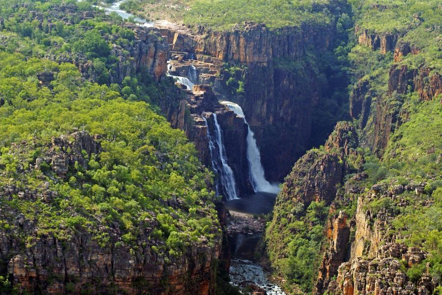
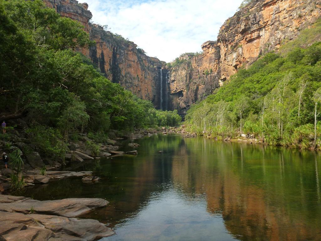
Chasms and gorges dissect the rocky platforms on the plateau. The plateau top is a harsh, dry environment where water drains quickly and topsoil is scarce, with pockets of open forest and woodlands. Creeks have carved deep gorges in the escarpment in which tall monsoon forests grow. These areas form microclimates for plants and animals and often serve as a refuge during the dry season.

During the wet season, water carried down from the Arnhem Land plateau overflows from creeks and rivers onto nearby floodplains. Nutrient-rich soils along with an abundance of water and sunlight make the floodplains prolific in plant and animal life. During the dry season the water recedes into rivers, creeks, and isolated waterholes or billabongs. Kakadu's wetlands are listed under the Convention on Wetlands of International Importance (the Ramsar Convention) for their outstanding ecological, botanical, zoological, and hydrological features.

Kakadu's coast and creeks and river systems under tidal influence extend about 100 kilometres inland. During the dry season tidal action deposits silt along the river beds and banks. During the wet season the river beds are eroded by the floodwaters which flow out across the tidal flats, where silt is deposited. Large silt loads are also deposited as a nutrient rich layer on the sea floor, the muddy waters of Kakadu's coastline, providing food for fish, prawns and crabs. The dominant habitats are mangrove swamps. Where freshwater springs occur along the coasts and river banks, coastal monsoon rainforests have formed.
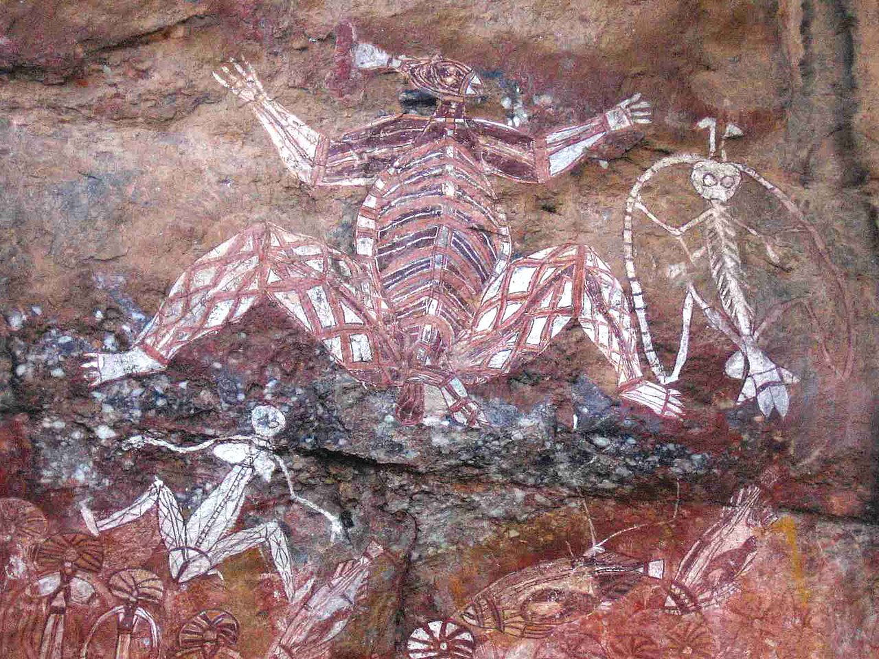
Aboriginal peoples have occupied the Kakadu area continuously for around 60,000 years. Kakadu National Park is renowned for the richness of its Aboriginal cultural sites. There are more than 5,000 recorded art sites illustrating Aboriginal culture over tens of thousands of years. The name Kakadu originates from the mispronunciation of Gaagudju, the name of an Aboriginal language spoken in the north-western part of Kakadu National Park.
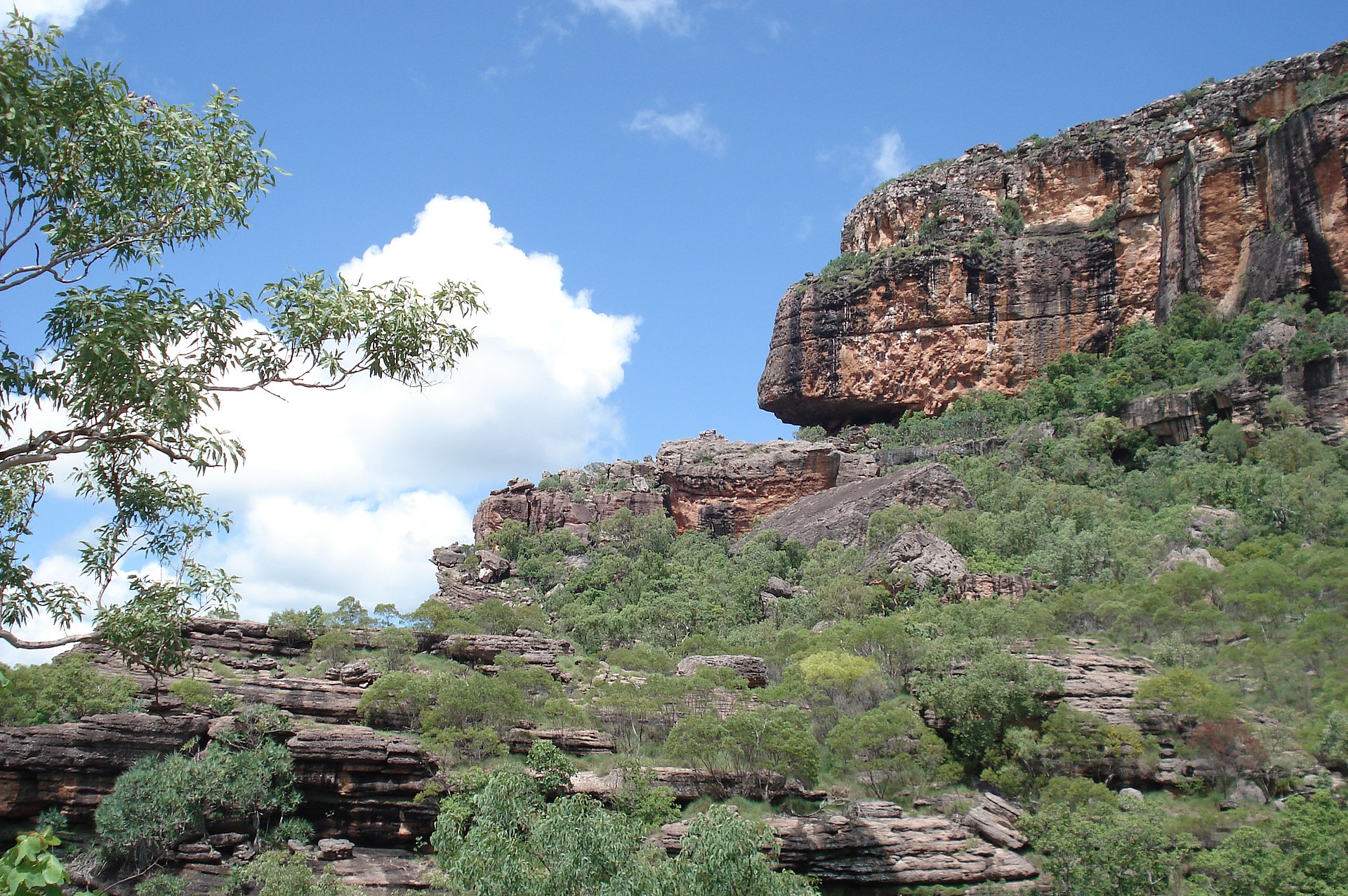
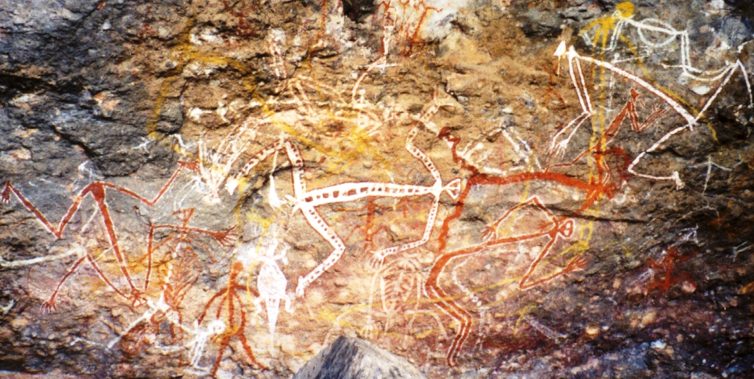
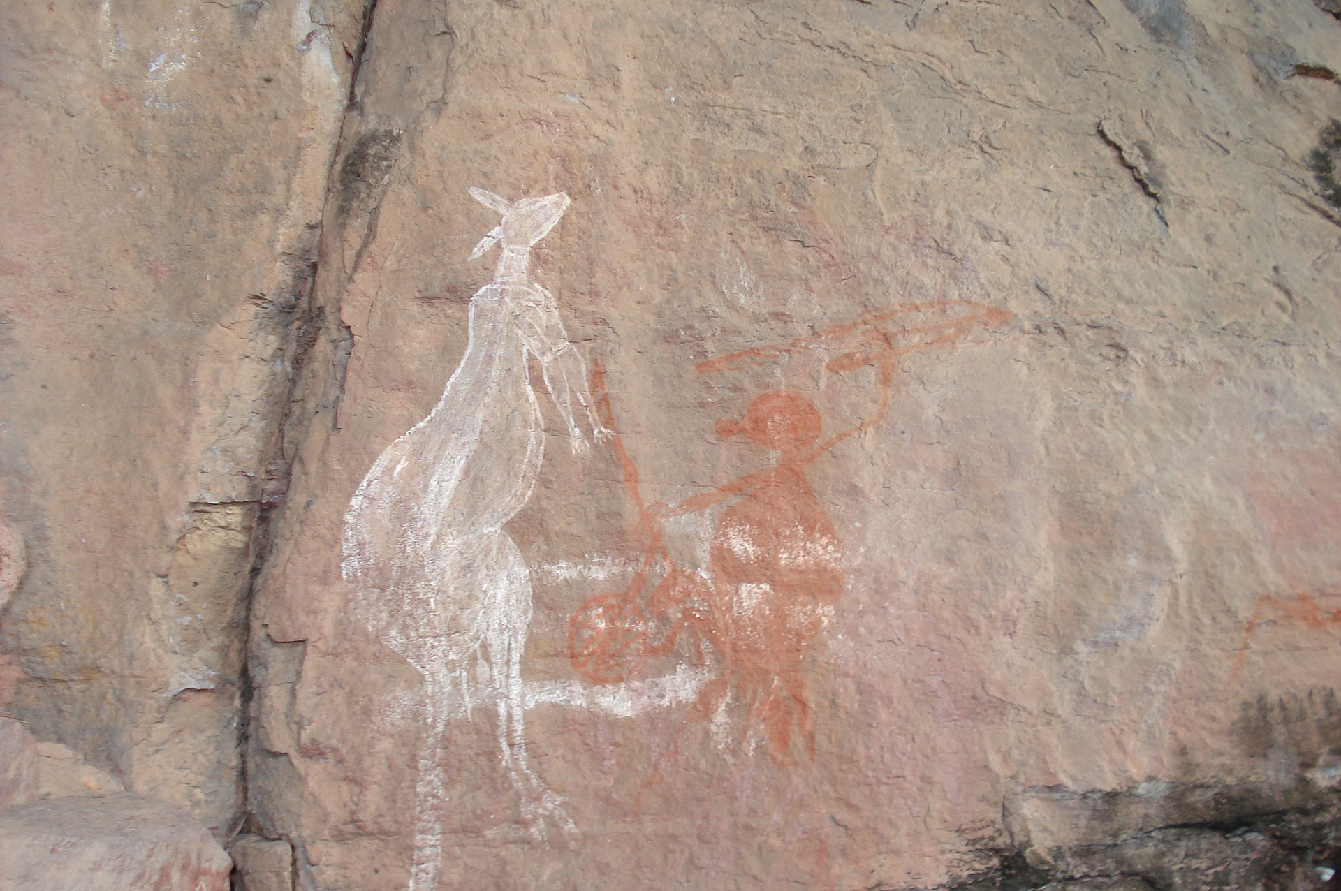
The art sites of Burrunguy (Nourlangie Rock) and Nanguluwur are internationally recognised as outstanding examples of Aboriginal rock art. Some of the paintings are 20,000 years old, among the longest historical records of any group of people on earth. The local Aboriginal word for rock art is "kunbim". These sites are in rocky outcrops that have afforded shelter and homes to Aboriginal people for tens of thousands of years.
Burrunguy, or Nourlangie Rock, is in an outlying formation of the Arnhem Land Escarpment, which contains overhangs, caves and shelters linked by ancient paths and stairways. The shelters contain amazing paintings that represent the Aboriginal Dreaming, with depictions of Namandi spirits, both male and female figures and one with six fingers on each hand. Pigments are of yellow, white and red ochre, with red ochre used as chalk to draw on the rock surface. Early art at the site includes handprints on the rock in red pigment.
The paintings at Burrungui are in the Mimi and x-ray styles, with Mimi being older and representative of Dreaming Ancestral beings.

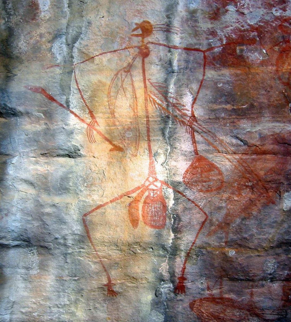
X-ray paintings are naturalistic depictions of animals that show the internal organs, skeletons and other anatomical features, which were mostly painted by Aboriginal people in red and white ochre. There are paintings of Thylacines (Tasmanian Tigers), which have been extinct in the area for at least 3,500 years.
Nanguluwur is a small art site, near Nourlangie, which displays different rock art styles. These include hand stencils, dynamic figures in large head-dresses carrying spears and boomerangs, representations of Namandi spirits and mythical figures, including Alkajko, a female spirit with four arms and horn-like protuberances.
Anbangbang Billabong lies under Nourlangie Rock and is inhabited by a wide range of wildlife which have sustained thousands of generations of Aboriginal people. The Anbangbang Shelter drawings are some of the most famous in the National Park. Anbangbang was excavated by archaeologists in 1981 and found to have been occupied 20,000 years ago.
The Ranger Uranium Mine, one of the most productive uranium mines in the world, is surrounded by the Kakadu National Park, and is apparently being closed and rehabilitated.
© This work is copyright. Apart from any use permitted under the Copyright Act 1968, no part may be reproduced by any process, nor may any other exclusive right be exercised, without the permission of Peter Searle, peter@portseavillageresort.com; 1980-2024.
Website built by Justin O’Dea www.webdeveloperdocklands.com.au