
AsianOverland.net
Tour Guide - Itinerary
Asian Overland Sydney to London
Started 22/06/2022 Finished 21/06/2023365 Days ITINERARY
Day 32 date 23/07/2022UBIRR to LITCHFIELD NATIONAL PARK
.jpg)

ASIANOVERLAND.NET SYDNEY TO LONDON DAY 32: UBIRR TO LITCHFIELD NATIONAL PARK
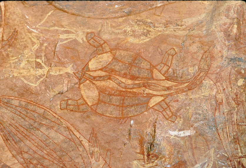
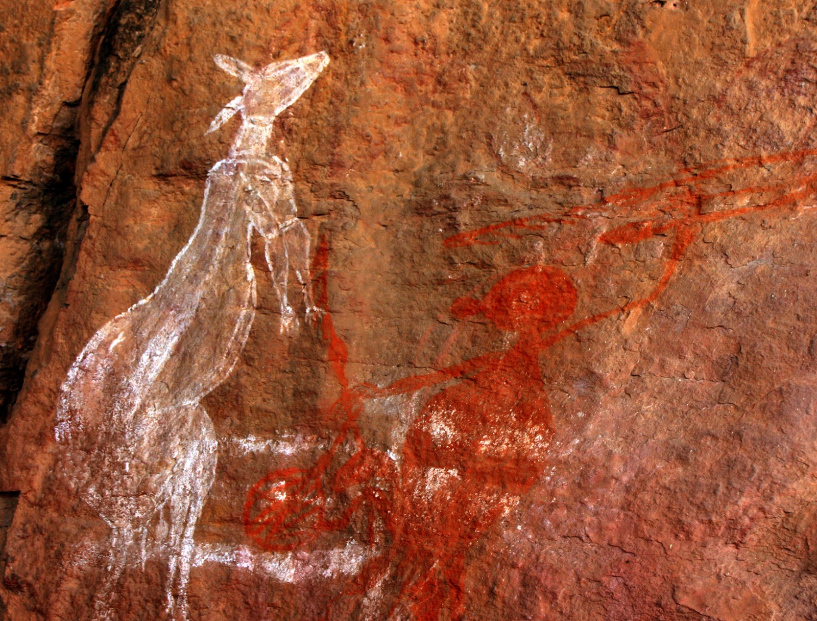
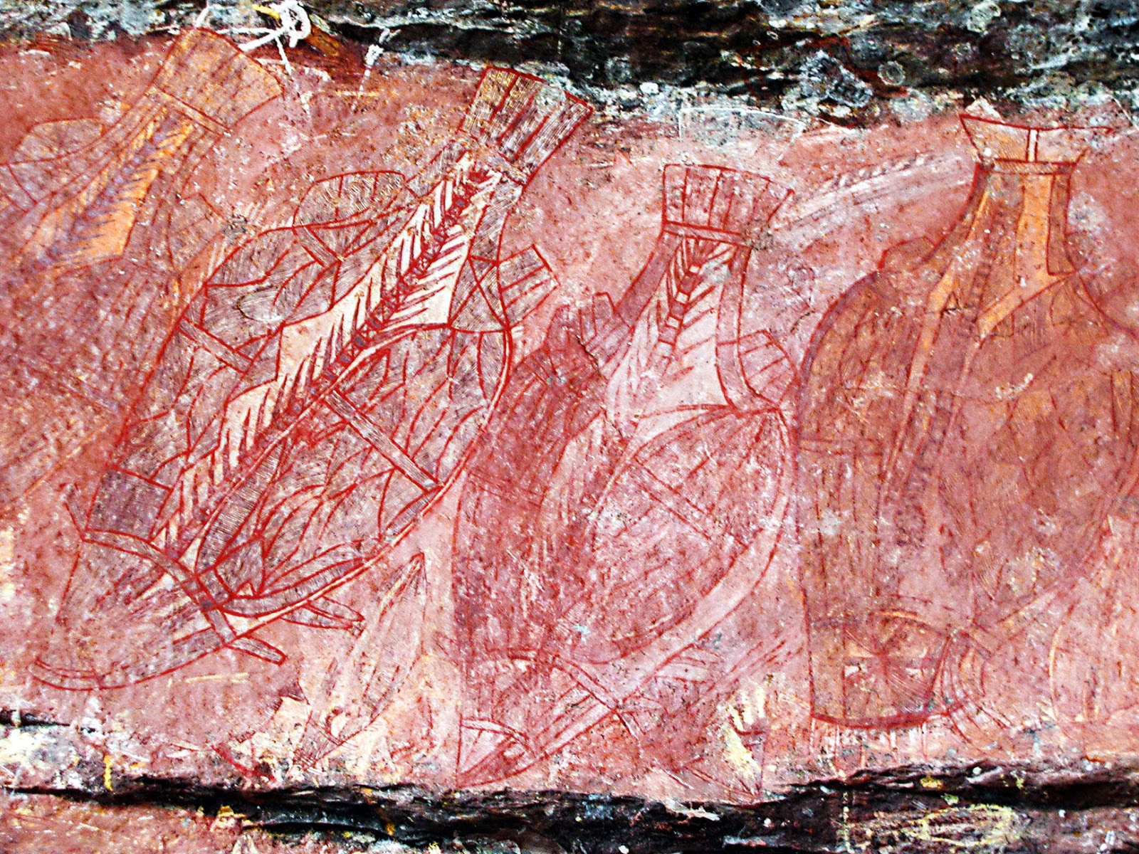
Aboriginal people have lived continuously in the Alligator Rivers region for at least 50,000 years. The region has a rich heritage with cave paintings and rock carvings in over 1500 sites. Many ancient Aboriginal artefacts have been found in cave shelters and old camping grounds in the region.

At Ubirr Rock near Cahill's Crossing on the East Alligator River, some paintings dating from 20,000 years ago have figures throwing spears and wearing headdresses, and x-ray fish and other animals date back 30,000 years.
The Gagudju people live in the area between the East and South Alligator Rivers and share responsibility for part of Kakadu National Park which lies within their country. Gunbalanya (named Oenpelli when I first visited in 1984), is run by an Aboriginal council and is an important centre for arts and crafts (as well as an airport, which I first landed on in 1984 en route to Jabiru, Kakadu).
A songline is a "dreaming track" which marks a route across the land or sky followed by one of the creator-beings or ancestors in the Dreaming.
Australian Aboriginal people were able to navigate across their country by repeating the words of the song, which describe the location of landmarks, waterholes, and the paths of the creator-beings evident from their marks on the land.
By singing the songs in the appropriate sequence, Aboriginal people could navigate vast distances through the deserts of Australia, hundreds of kilometres through the country of many different Aboriginal peoples who speak different languages and have different traditions. One songline marks a 3,500-kilometre route connecting the Central Desert Region with the east coast, to the place now called Byron Bay. Desert people travelled to the ocean, and coastal people travelled inland to sacred sites including Uluru and Kata Tjuta.
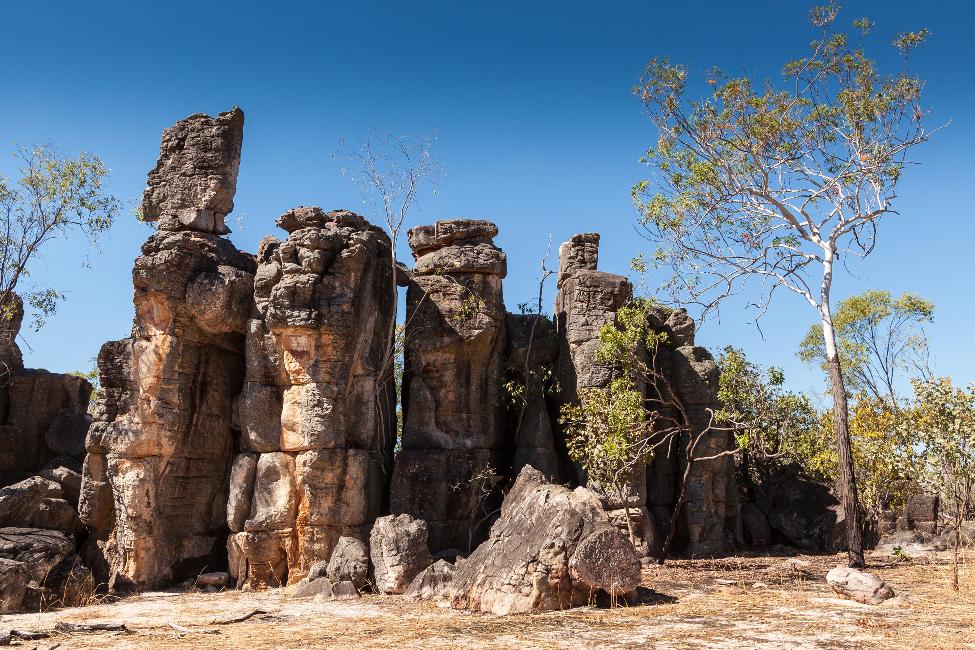
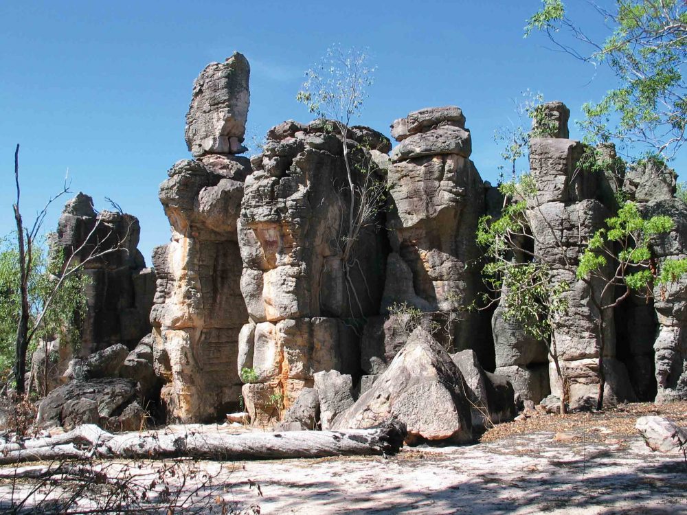
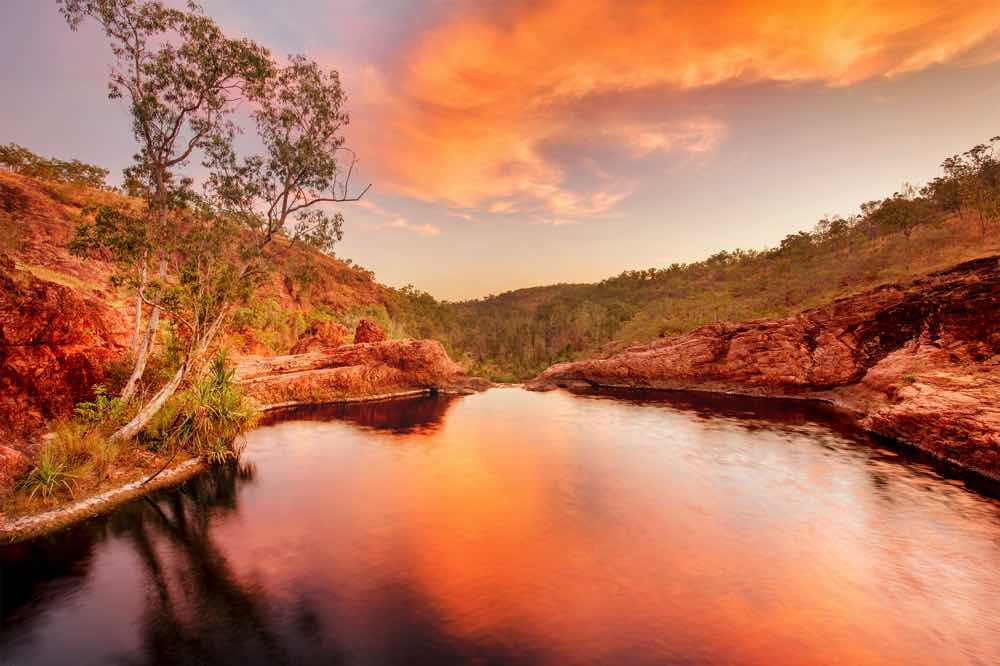
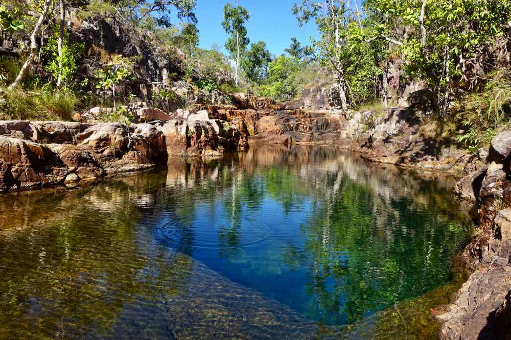
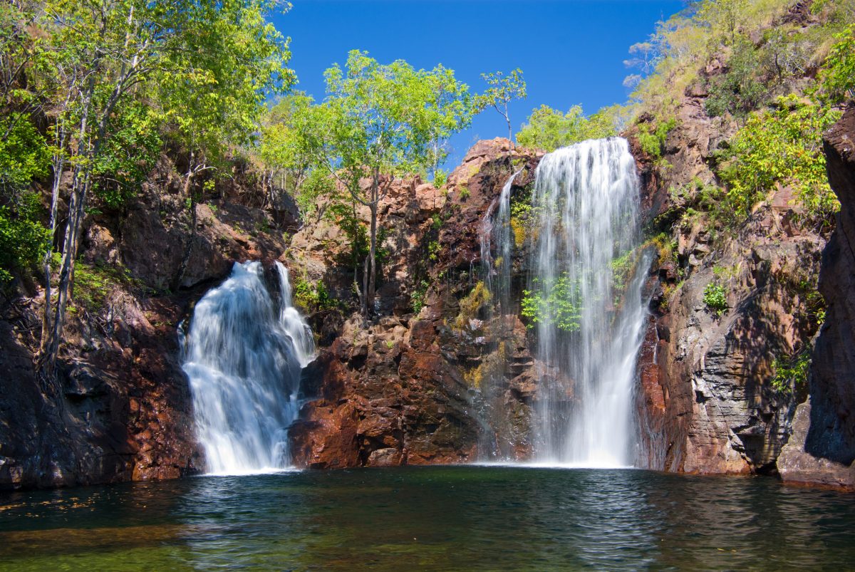
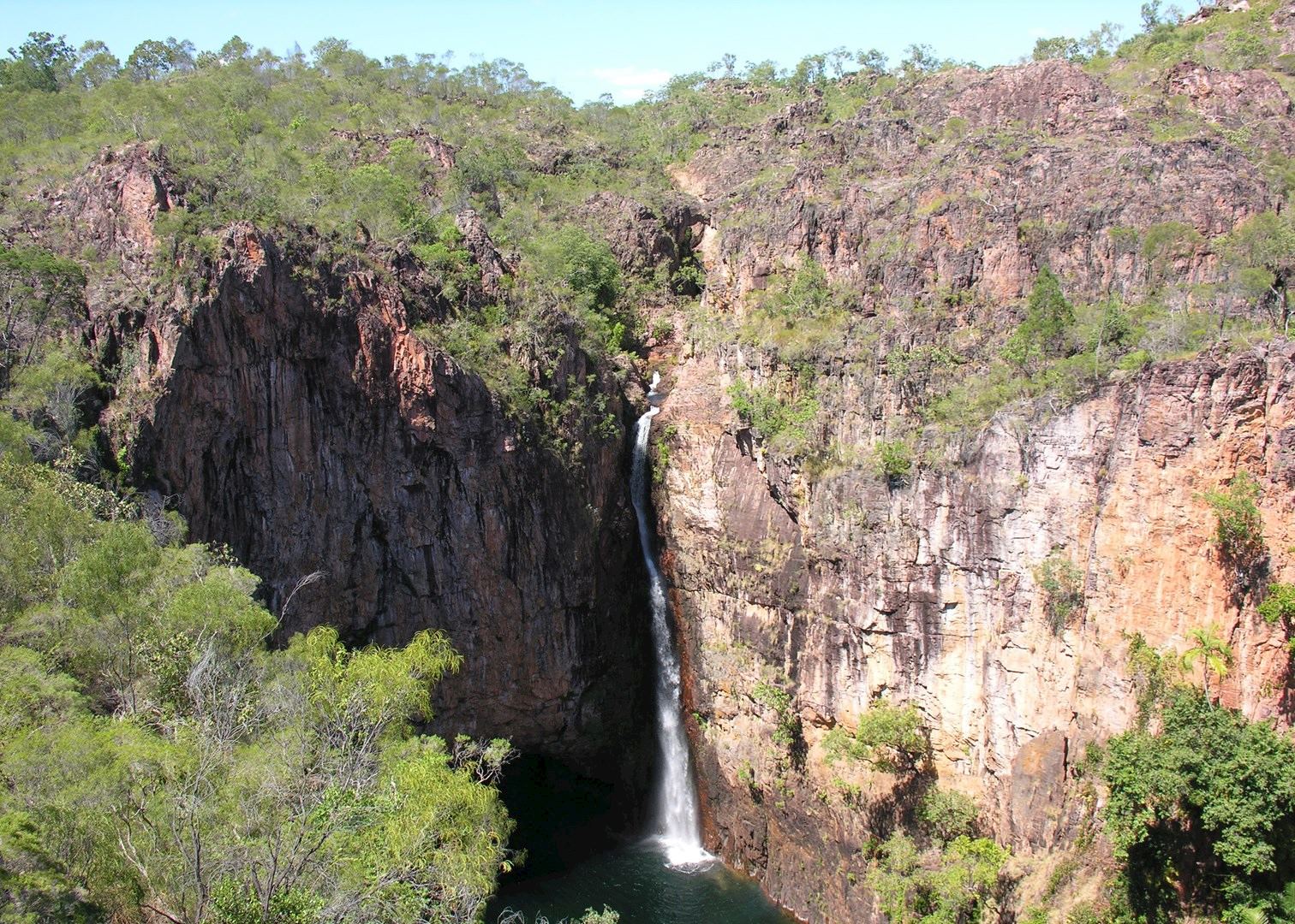
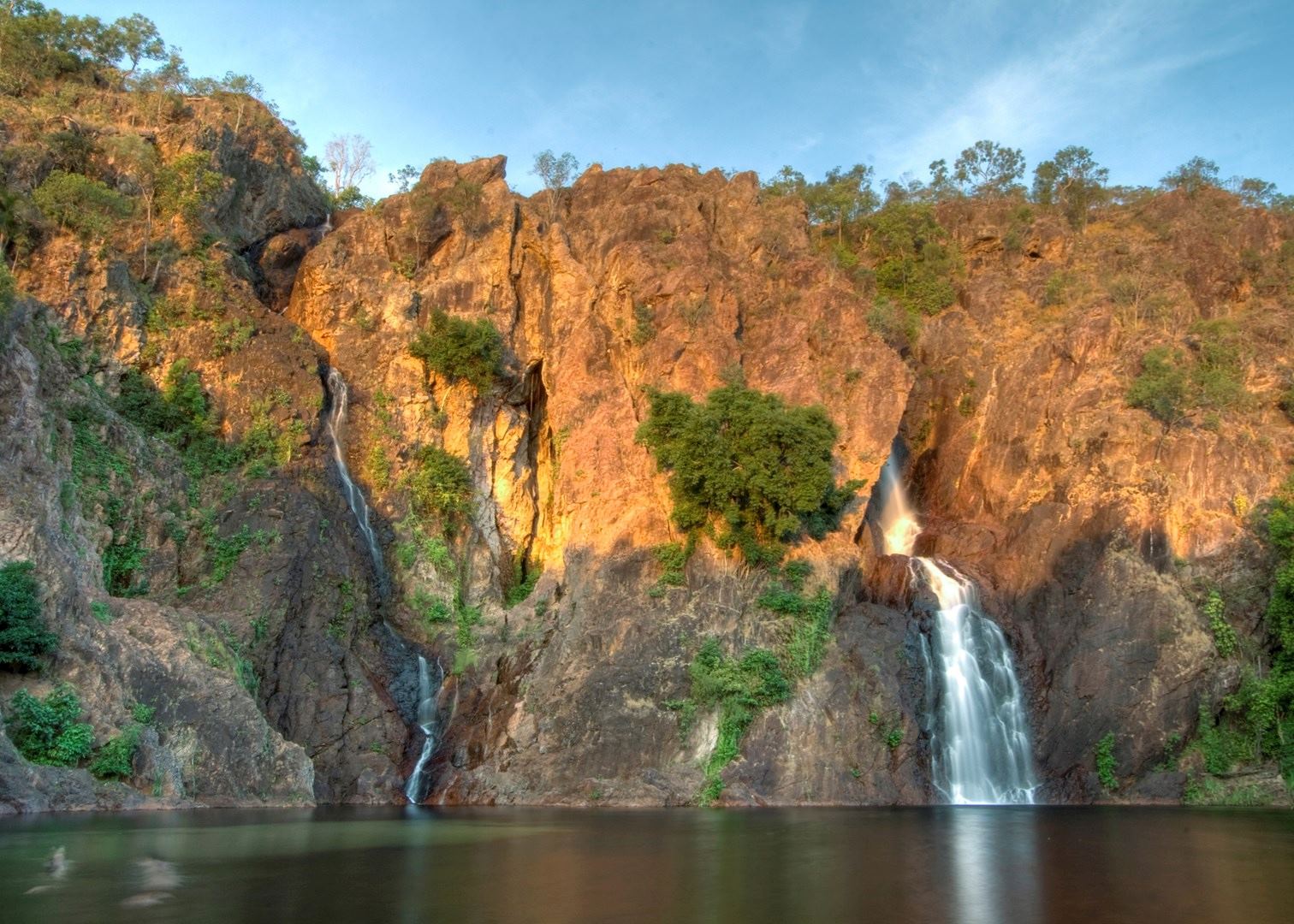
Litchfield National Park is an ancient landscape covering approximately 1,500 km2 which is largely shaped by water. It is home to stunning waterfalls cascading into crystal clear pools, iconic magnetic termite mounds, unique fauna and flora, and clusters of weathered sandstone pillars.
The Central sandstone plateau supports rich woodland flora communities dominated by species including Darwin woolybutt and Darwin stringybark, as well as banksias, grevilleas, terminalias and a wide variety of other woodland species.
Pockets of monsoon rainforest thrive along the bottom of the escarpment, and in the deep narrow gorges created over thousands of years by waterfalls cutting into the escarpment walls. Lilies and slender ground orchids grow among Pandanus, paperbark and swamp bloodwoods. Orchid tubers have always been a common Aboriginal food from the far north to the far south-east of Australia.
Common wildlife species include the antilopine kangaroo, agile wallaby, sugar glider, northern brushtail possum, fawn antechinus, black and little red flying foxes and the dingo. Fresh food for the Indigenous people for tens of thousands of years. The caves near Tolmer Falls are home to a colony of the rare orange leaf-nosed bat and the ghost bat.
Litchfield is a habitat for hundreds of native bird species. Black kites and other birds of prey are common during the dry season. The yellow oriole, figbird, Pacific koel, spangled drongo, dollarbird and the rainbow bee-eater inhabit the sheltered areas close to waterfalls. A species of marsupial mouse (the northern dibbler), the rufous-tailed bush-hen, a frog (the pealing chirper) and the primitive archerfish, inhabit the Wangi Falls area.
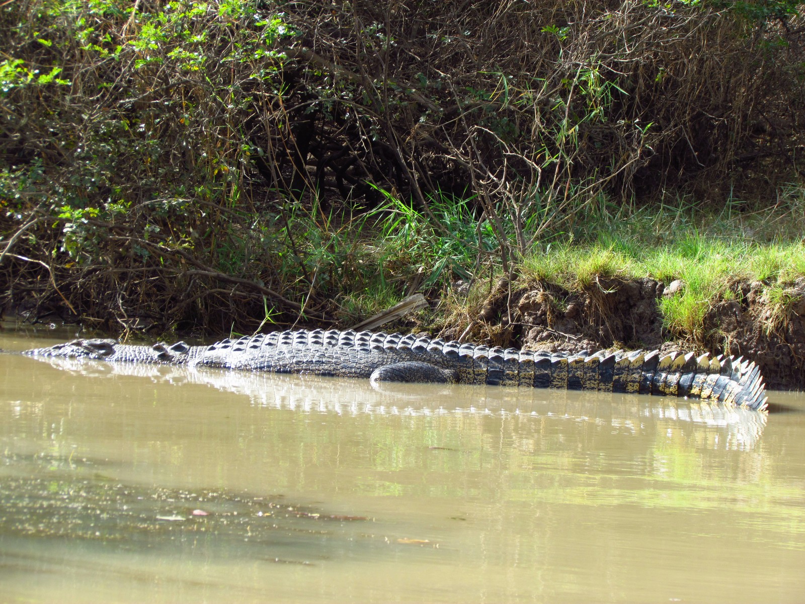
The falls have large pools that attract birds and reptiles such as monitors, orange-footed scrubfowl, honeyeaters, figbirds. Torres Strait pigeons share the fruit and berries with nocturnal mammals like the northern quoll, northern brown bandicoot and northern brushtail possum. Frill-necked lizards are common throughout the park. The Finniss River area also hosts a large number of large saltwater crocodiles.
The magnetic termite mounds are aligned in a north–south direction as a response to the environment. The termites which build them feed on grass roots and other plant debris found in plains which are seasonally flooded, so the termites are forced to remain above the water, in the mound. The alignment of the mound acts as a temperature regulator, and allows the temperature to remain stable. Termite mounds are a common feature of Kakadu, and Arnhem Land, as well as Litchfield.
© This work is copyright. Apart from any use permitted under the Copyright Act 1968, no part may be reproduced by any process, nor may any other exclusive right be exercised, without the permission of Peter Searle, peter@portseavillageresort.com; 1980-2024.
Website built by Justin O’Dea www.webdeveloperdocklands.com.au